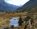
The Routeburn was a classic tramp before DOC commercialised it, but despite the clutter, it is still worth doing.
Fit trampers will be able to walk from the Routeburn car park to a campsite on the Greenstone Saddle in one long day, and then
exit via the Caples or Greenstone on a second day. There are good campsites in the north branch of the
Routeburn (go 500m from the Routeburn track to avoid DOC's ban) and in the Caples and Greenstone.
The side trip to Conical Hill from the Harris Saddle is well worthwhile.
Crossing the McKellar Saddle and descending the Caples is more strenuous than the Greenstone, but also
more beautiful. From the Caples it is possible to cross back to the Routeburn car park via Fraser Creek and Emily Creek,
or to six kilometers below the Routeburn car park via Kay Creek and Scott Creek (see sf).
- Routeburn - Caples (two or three days).
- Routeburn - Greenstone (two or three days).
- Caples - Greenstone (two or three days).
- Routeburn - Caples - Fraser - Emily (three or four days).
- Routeburn - Caples - Kay - Scott (three or four days).
The Routeburn, Greenstone, and Caples valleys are all easy tramping, and are well described in Moir's Guide Book North.
Caples -- Greenstone
The photos are from a two-day tramp in early December, 2017
 |
 |
 |
 |
 |
| Caples |
Caples |
Caples |
Caples |
Pass |
 |
 |
 |
 |
| Christina |
Greenstone |
Greenstone |
Greenstone |
Photos are from a 2 day tramp/bike in 2018.
The times in Moir's Guide are fairly generous. Here they are (with mine in brackets).
Road to mid-Caples Hut 2.5 (3); upper-Caples Hut 2.5 (2.5); McKellar Saddle 3.5 (3)
Greenstone Pass 2.5 (1.5).
Camp on pass.
Howden Hut (0.5); Lake McKenzie 3-4 (3.0); Harris Saddle 4 (4); Road 5.5 (4.5);
Bike 30 km to Greenstone car park (2 hours).
 |
 |
 |
 |
| Upper Caples |
Upper Caples |
Lake Howden |
Lake McKenzie |
Routeburn
For more photos, see
Conical Hill
 |
 |
 |
 |
 |
| Routeburn |
Lake Harris |
Lake Harris |
Martins Bay |
Tutoko |
 |
 |
 |
 |
 |
| Moraine Creek |
Tutoko |
Tutoko |
Lake Mackenzie |
Lake Mackenzie |
 |
 |
 |
 |
| Caples |
Caples |
Caples |
Caples |
 |
 |
 |
 |
| Caples |
Christina |
Christina |
Winter |
 |
 |
 |
 |
 |
| Waterfall |
Cows |
Greenstone |
Winter |
Winter |
DOC's damage to the Route Burn Valley
 |
| DOC's destroyer of tracks, at work below the Route Burn flats, December 2014. |
I have been walking the Route Burn for over fifty years, and every year
DOC seems to have inflicted further damage on the valley: the beautiful old track
has been bulldozed and blasted into oblivion;
the Falls have been marred by the addition of a small
village;
the beautiful old swing bridge at the start has been replaced by one capable of carrying a small bus load;
an ugly toilet has been added only 45 minutes from the road and 45 minutes from the Flats hut; etc.
While DOC spends vast sums reconstructing the Route Burn valley to the
tastes of the wealthy guided tourists, it allows the rest of the
network of tracks and bridges at the head of Lake Wakatipu to fall
into disrepair.
HOME
Email: 
Copyright © 2013, 2014 J.S. Milne.


![]()