Gallery of NZ Photos -- J.S. Milne
Please view them full screen (F11). Use Alt-left arrow (or whatever) to go back from photo. Click the thumbnail to view the photo. Bowen Valley, from Deepwater Basin, Fiordland.
 Arthur Valley, from Deepwater Basin, Fiordland.
 Piopiotahi (Milford Sound), from Deepwater Basin (Mitre Peak at left), Fiordland.
 Lake Ada, from the Milford track, Fiordland.
 Sutherland Falls (top two leaps), Fiordland.
 Sutherland Falls (all three leaps), Fiordland.
 Arthur River and Deepwater Basin, from Sandfly Point, Fiordland.
 Sunrise, Whakatipu.
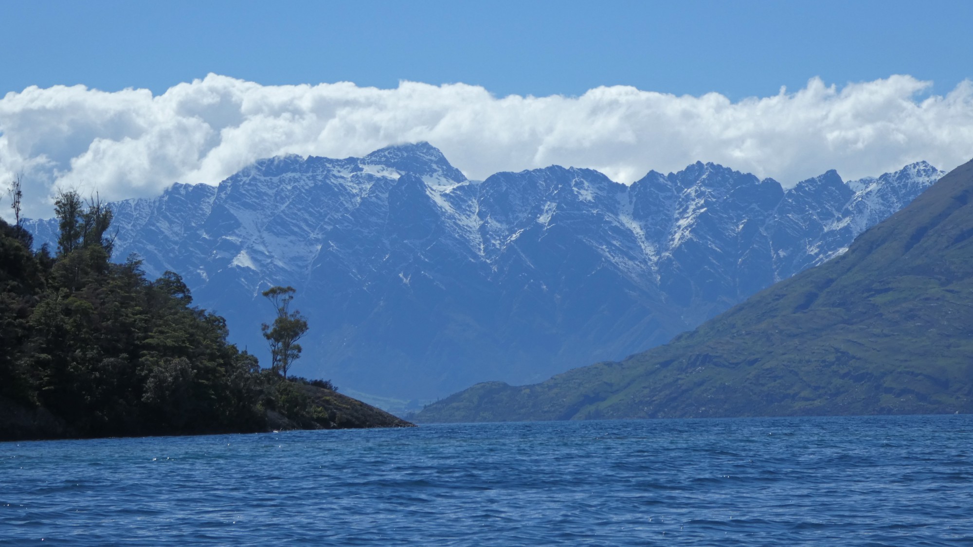
 View towards the head of Lake Whakatipu from the walk on Pigeon Island, Whakatipu.
 View towards the head of Lake Whakatipu from Twenty-Five Mile Creek, Whakatipu
 Rees Valley, Whakatipu.
 Rees Valley, Whakatipu.
 Haast Beach. West Coast.
 Setting sun, from my camp on the Mataketake Tops. West Coast.
 Mataketake Tops. West Coast.
 Kayaking in the Okarito River Delta wetland, West Coast.
 Three Mile Lagoon and the Southern Alps (Okarito Pack Track), West Coast.
 Three mile lagoon (Okarito Pack Track/Coastal Walk), West Coast.
 Lake Mapourika. West Coast.
 Lake Mapourika. West Coast.
 Sunlit tree fern in a dark forest. On Monroe beach walk. West Coast.
 Bush in Scott Creek, Whakatipu.
 The morning after pandemic restrictions were relaxed (in 2020) was the perfect time for a paddle. Whakatipu.
 Sunrise. Whakatipu.
 Valley of the Trolls, Whakatipu.
 Camp in the Valley of the Trolls, Whakatipu.
 Whakatipu.
 Sunrise. Whakatipu.
 Mount Christina, from the McKellar Saddle (between the Caples and the Greenstone valleys), Whakatipu.
 Home Hill Hut (old musterers' hut), on crossing from Greenstone to the Caples, Whakatipu.
 Valley of the Trolls. Whakatipu.
 From near the Cascade Saddle, Wanaka.
 Sunrise. Whakatipu.
 Nor'Wester in the Caples. Whakatipu.
 Earnslaw Burn, Wakatipu.
 A waterfall in the Leader Creek valley, from the Tutoko Valley, Fiordland.
 From the Gertrude Saddle, towards the coast. Fiordland.
 Kayaking back from The Monument, I stopped at a point before Stony Point. View is across Lake Manapouri to the Beehive.
 View north from the top of The Monument, Manapouri, Fiordland.
 The 100+ year old steamer, the Earnslaw. Whakatipu
 Cairn and beech forest, Mt Crichton, Wakatipu.
 Falls Creek, Fiordland.
 Side creek on the track above Welcome flat, Copland Valley, West Coast.
 Mt Avalanche from c1750m on French ridge, Wanaka.
 Forest on the Kaituna track, Nelson.
 Struggling to survive, Puponga Hilltop Walk, Nelson.
 Cape Farewell, Puponga Hilltop Walk, Nelson.
 Wharariki Beach, Puponga Hilltop Walk, Nelson.
 Rock formation on the climb of Mount Owen, Nelson.
 View from ridge between Blue and Granity creeks, Mount Owen, Nelson.
 From Key Summit, Fiordland.
 Lake Unknown, Whakatipu
 Sugar Loaf Creek, Whakatipu.
 Green Lake, from above the track to Lake Monowai, Fiordland.
 Near the outlet of Lake Hauroko, Fiordland.
 Lake Manapouri from Mount Titiroa, Fiordland.
 Sunrise on the ridge of Mount Titiroa. Fiordland.
 Murray Beach and Gull Rock Point, Rakiura (Stewart Island)
 Boardwalked track near Christmas Village Hut, Rakiura (Stewart Island)
 Kea and Mount Tasman, from Fox Peak, West Coast.
 Farm, West Coast.
 Kea on the ridge above the Cascade Saddle, Wanaka.
 Te Wera (at left), Tutoko (behind), and Madeline from Conical Hill, Whakatipu.
 Sunrise on the Footstool, Aoraki.
 Mt Cook (and melted glacier), in winter, Aoraki.
 Lake McKerrow from McKerrow Island, Fiordland.
 Fork Hut, Huxley Valley, Canterbury.
 Mount Christina and Crosscut, from the McKellar Saddle (between the Caples and the Greenstone valleys), Whakatipu.
 Sabre, Fiordland.
 Moraine Creek, Fiordland.
Copyright © 2022, J.S. Milne.