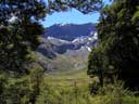
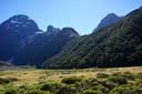
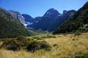
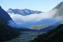
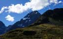
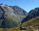
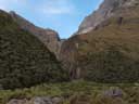
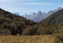
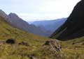
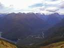
This range is north of Lake Te Anau, and is easily accessible from the Milford road.
Each of valleys, Hut Creek, Mistake Creek, and Falls Creek, can be done as day trips, but each
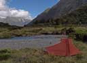
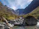
merits more time. Campsites are easy to find on the flats above the bush. The valleys are linked
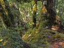
by passes. The tracks into the valleys through the bush are generally well marked, but indifferently maintained.
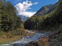
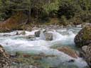
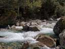
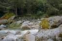
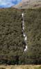
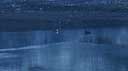
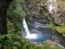
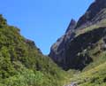
Crossing Mistake Creek is difficult after rain, which is not uncommon --- see the photos.
Hut Creek
 |
| Hut Creek |
Mistake Creek
 |
 |
 |
 |
 |
 |
| Track |
Up valley |
Ford |
Ford |
Ford |
Camp |
 |
 |
 |
 |
 |
 |
| Hanging valley |
Valley head |
West branch |
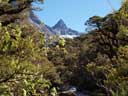
Ngatimamoe |
Forest |
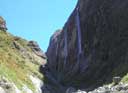
Waterfall |
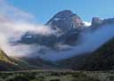
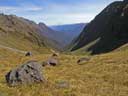
Head of valley
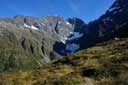
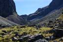
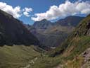
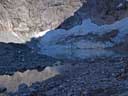
It is about a three hour walk from the start of the
flats to the tarn at the head of the valley and back.
 |
 |
 |
 |
 |
| Valley head |
Down valley |
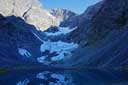
Tarn |
Putangitangi |
Down valley |
East branch (hanging valley under Consolation Peak)
 |
 |
 |
 |
 |
 |
| Bush climb |
Flat Top |
Ngatimamoe Pk |
Hanging valley |
Hanging valley |
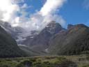
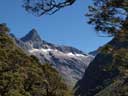
Consolation Pk |
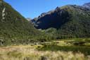
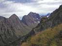
West branch (to U Pass).
 |
 |
 |
 |
| West branch |
Consolation Peak |
Waterfall |
Consolation Peak |
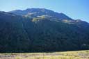
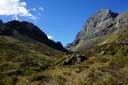
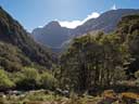
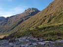
The track to the bushline is overgrown with tree falls, and so takes longer than advertised, but is generally well marked. Above
the bush there is about 100 metres of dense subalpine scrub, after which travel to the head of the valley is good.
Camping is possible on a small flat in the bush at about 820m, and on the flat above the bush.
 |
 |
 |
 |
 |
| Falls |
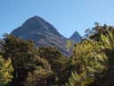
Pyramid Pk |
Pyramid Pk |
Ngatimamoe Pk |
Creek |
 |
 |
 |
 |
| Consolation Peak |
Tarn |
Valley head |
Emily Pk |
Glade Pass
 |
 |
 |
 |
 |
| To Glade Pass |
To Glade Pass |
U Pass |
Glade Burn |
Glade Burn |
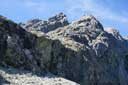
Notes: The climb to Glade Pass is steep, but there is plenty of vegetation to hang onto (so
long as the last vegetated strip remains). You will have no problem losing the track in
Glade Burn --- there isn't one. However, deer trails and the stream bed can be used for
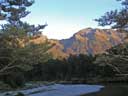
a fairly easy descent. From a campsite near Glade Burn and the Dore Pass track, it is possible to walk
to the Mackinnon Pass and back in a long summer day (see
here).
.
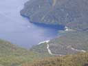
Dore Pass
 |
 |
 |
 |
| Dore Pass |
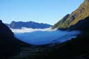
Glade valley |
Lake Te Anau |
Clinton River |
Caution: Dore Pass is used by helicopters supplying the Milford track. The day I crossed
the pass, there was a constant stream of helicopters hurtling over the pass with their loads
swinging below. Instead of enjoying an leisurely lunch on the pass, I could only cover
my ears, keep my head down, and get over as quickly as possible.
HOME
Email: 
Copyright © 2010, 2011, 2012, 2013, 2014 J.S. Milne.
