China 2000: Mustagh Ata, J.S. Milne
Mustagh Ata (7546m, 24750ft) lies in western China, about 25 kilometres east of Tajikstan and about 75 kilometres north of Pakistan. It was attempted in 1947 by the famous British climbers Shipton and Tilman, who turned back only about 100m below the summit exhausted from making a trail in the deep soft snow and suffering from altitude sickness and frostbite. The same three problems --- deep soft snow, altitude, cold --- have plagued climbers ever since. Otherwise, it is an easy mountain.
Today, almost all climbers use snowshoes or skis to help combat the deep snow, but it is still difficult, and only about 20%--30% of the roughly 200 climbers who attempt it each year reach the summit. This year, even before we began our trip, there had been one death and two near-deaths on the mountain. Two Slovenian climbers were caught in bad weather during their summit attempt from a camp at 7000m (23000ft). Both were badly frostbitten; one managed to descend far enough to be rescued by another group, but the other died. Famed Himalayan climber Dan Mazur (Everest, K2,...) got cerebral edema while climbing a new route on the mountain, and only survived thanks to the efforts of his climbing partners. The normal route (West flank) is so gentle that it is almost impossible to fall off when it is in reasonable condition, but from time to time someone falls into a crevasse. And 7500m is very high --- because of the oxygen carried up by their sherpas, most of today's Everest climbers never, in effect, go much over 7000m.
Our own expedition originated when Siegfried, a Belgian living in China, read that the high altitude cycling record had been set on top of Aconcagua (6959m, 22825ft) and determined to beat it. Our group consisted of three cyclists (Siegfried, Luc, and Martin), two young Dutch alpinists (Peter and Stijn), and me. Since I had little confidence that the cyclists would be reaching the top, I joined with the understanding that I could solo the mountain if I wished. Here are our three stories.
My Tale
On July 25 Siegfried, Martin, Peter, Stijn, and I flew to Kashgar (1290m, 4230ft) in western China, and met Luc who had cycled there over the Karakoram highway from Gilgit in Pakistan. The next day we shopped in Kashgar for food and fuel.Day 1 (July 27). To Subashi (3640m, 11940ft)
While Martin set out to cycle to Subashi from Kashgar, the rest of us went by jeep (Karakoram highway).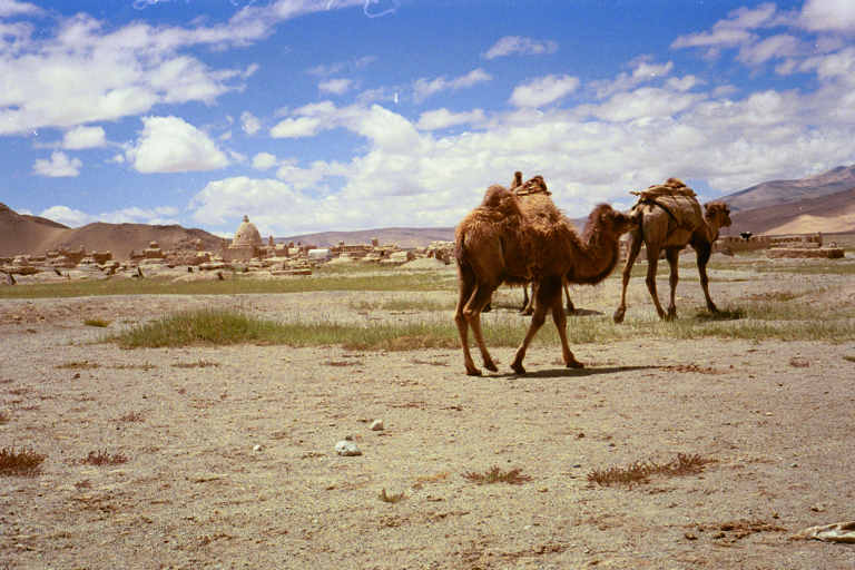
Camels, with the Subashi graveyard behind.
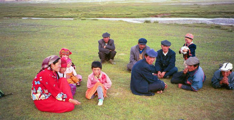
Some of the villagers.
Day 2 (July 28). Walks near Subashi
We spent the day acclimatizing at Subashi. While Peter, Stijn, and I climbed some nearby hills, Luc and Siegfried went cycling.
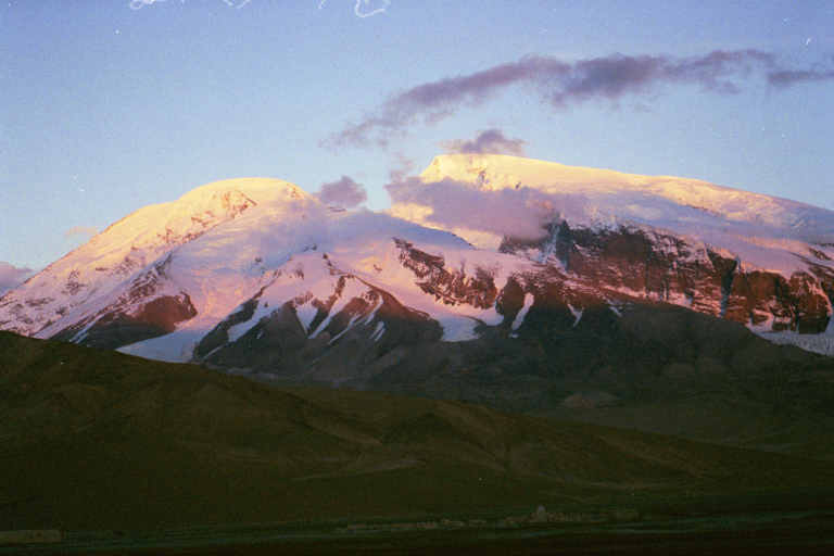
Mustagh Ata from Subashi.
Day 3 (July 29). To Base Camp 4440m (14560ft)
In the morning Peter was very ill with altitude sickness, and so he and Stijn went back down the road to a lower altitude. We had hired camels to carry our food and gear to base camp. I walked with them, while Luc and Siegfried cycled. [For the curious, hiring a camel for one day costs $28, and they can carry up to 80kg.]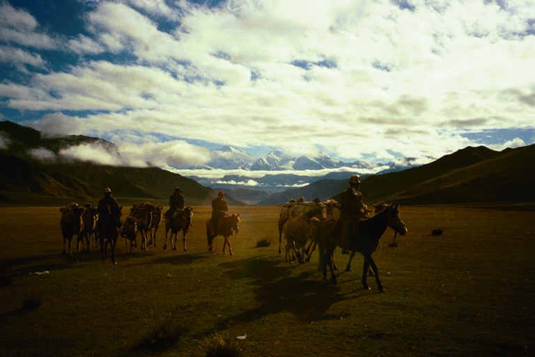
The camel train arriving at our camp. The peak behind is Kongur 7719m (25300 ft).
Day 4 (July 30). At Base Camp 4440m (14560ft).
Spent day acclimatizing at base camp. Climbed up 485m (1590 ft) in one hour.
Day 5 (July 31). At Base Camp.
It snowed during the night at base camp, but the snow melted quickly once the sun came out.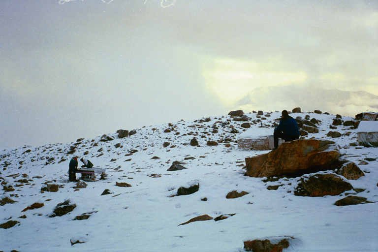
Undaunted, Siegfried and the others continue playing billiards at base camp after the snowfall.
Spent day acclimatizing at base camp. Climbed up 540m (1770 ft) in one hour.
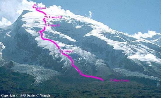
Day 6 (August 1). To Camp 1 (5440m, 17840ft)
I moved to Camp 1. Camp 1 is at the top of a rock/scree ridge, just before the glacier.
Tents at Camp 1 --- the new snow lingered longer there than at Base Camp.
Day 7 (August 2). At Camp 1 (5440m, 17840ft).
I made a trip down to Base Camp and returned with two weeks food.Day 8 (August 3). At Camp 1 (5440m, 17840ft).
Rested and acclimatized at Camp 1.
Day 9 (August 4). At Camp 1
I set off with a load towards Camp 2 (6220m, 20400ft). Climbed a gentle slope, and then navigated a small ice-fall. Above the ice-fall I had to break trail in soft snow (in snowshoes). At about 6100m (20000ft) I decided I'd leave the last 100m (330 ft) of trail-breaking for someone else, dumped my load, and returned to Camp 1.
On the climb to Camp 2 before the ice-fall; Kongur behind.
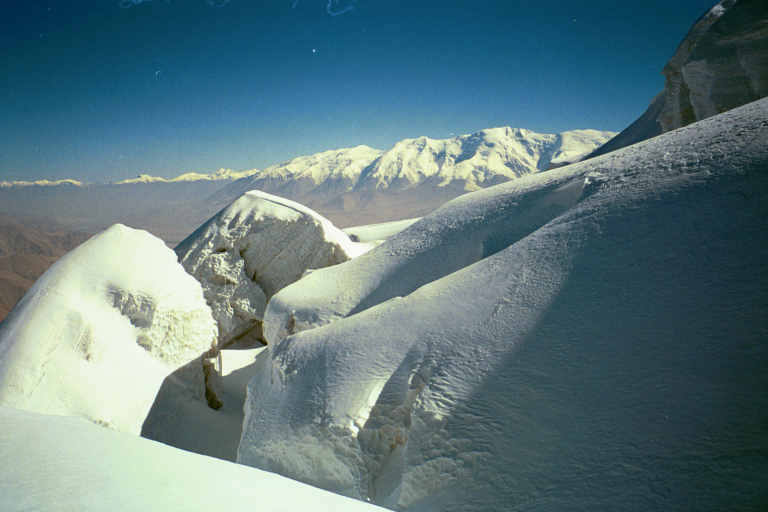
Crevasses in the icefall; Kongur behind.
View in the icefall.
Day 10 (August 5). To Camp 2 (6220m, 20400ft).
Climbed 800m (2600 ft) from Camp 1 to Camp 2 with a load in 4 1/4 hours. Set up tent, and collected load from previous day.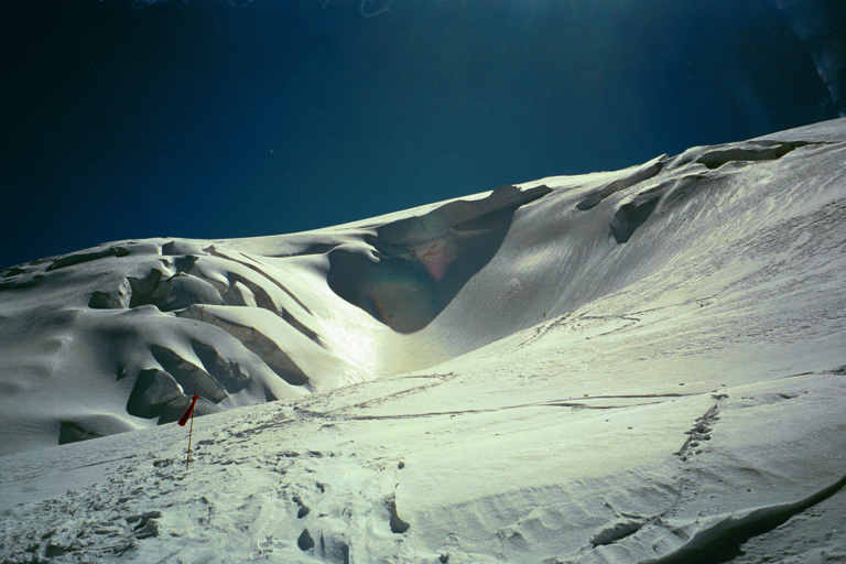
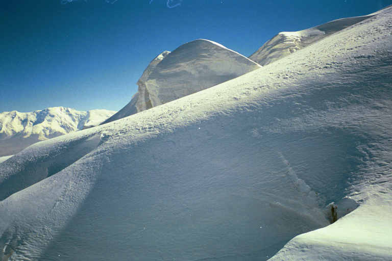
View from above the icefall --- the foreground slope leads to Camp 2 up to the right.
Day 11 (August 6). At Camp 2 (6220m, 20400ft).
Rested at Camp 2, except went for a walk to test my fitness --- climbed 300m to 6500m in 1 1/4 hours (1000ft to 21300ft). Good!
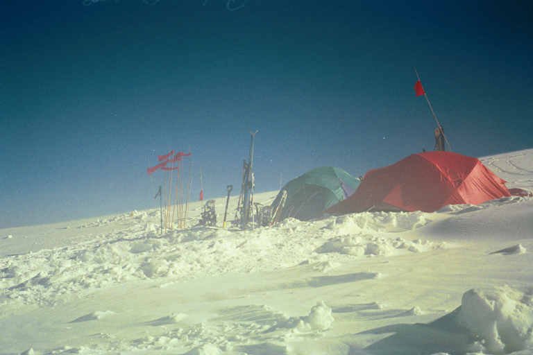
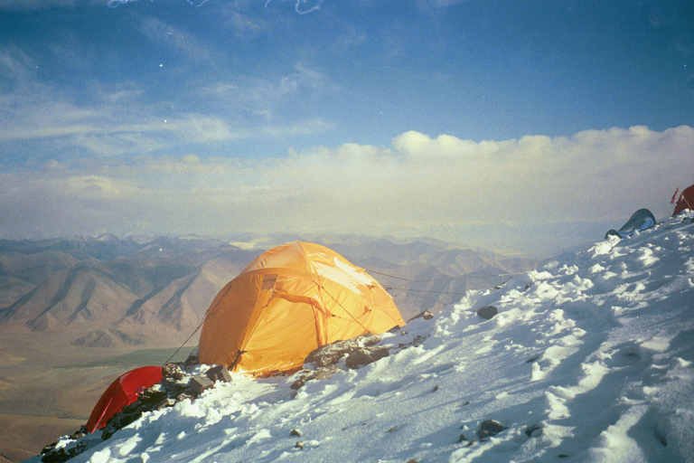
The tents of the 4-man Adventure Consultants group at Camp 2.
I now had to decide how to climb the mountain. Should I, as everyone else, set up a Camp 3 at about 6800m (22300 ft) and attempt the summit from there, or should I shoot for the top from Camp 2. The advantage of a Camp 3 is that you then only have 750m (2470 ft) to climb on the summit day. The disadvantage is that setting a camp that high is exhausting, and there is so little oxygen above 5500m that the body doesn't really recover from one exertion. Most people return to base camp after setting up camp 3 to rest before attempting the summit.
By contrast, climbing the peak from Camp 2 is elegantly simple, but could I climb from 6200m (20340 ft) to 7546m (24750 ft) --- 1350m (4400 ft) --- in a single day? I asked the Adventure Consultants guides. One (Hassan, a Pakistani with several 8000m ascents) said it was impossible to climb from 6200m to 7550m in a single day; the other (Mike, a Kiwi with several years experience guiding Mt. McKinley) said that if he were here alone, that's how he would be tempted to try it.
The Adventure Consultants group had been to Camp 3 and back that day, and so, if there was not too much wind in the night, there would be tracks to Camp 3. Moreover, there were two Hungarian climbers at Camp 3 who were attempting the summit tomorrow --- thus, with luck, I shouldn't have to break trail anywhere.
I decided that if the weather was good in the morning, and the wind not too bad in the night, I would try for the summit.
Day 12 (August 7). Attempt on the summit
The day dawned fine, and the wind had not been too severe in the night, so I left at daybreak (5:30) for the summit.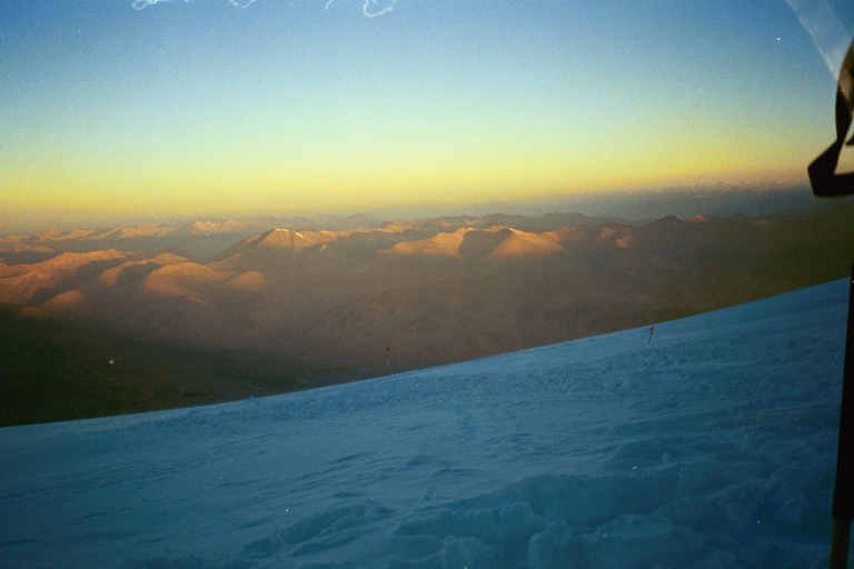
Dawn at Camp 2 (taken the day before my summit attempt, about 6am).
It was bitterly cold with a wind and no sun, and I was barely able to prevent my toes and fingers from being frostbitten. The snowshoe tracks from the previous day were blown out in places, but I made good time and passed Camp 3(6800m, 22300ft) at 8am. To my chagrin, the Hungarian climbers had not left yet, and so from then on I had to make my own tracks. Later, I saw the Hungarians leave about half an hour behind me, and they fell steadily further behind until I lost sight of them. At 7000m (23000 ft) I passed the vacant tent of the unfortunate Slovenians almost buried in the snow. Shortly after, the slope steepened, and I was having to take 5 breaths per step, but I still made reasonable time to reach the summit plateau (c7400, 24270ft) at about 12 o'clock. Here began the real struggle. At 1pm I was still about 100m (330 ft) below the summit, and only able to move upwards with great difficulty. Each step required 10 deep breaths. I left my pack, even though it weighed only about 4kg, and continued on with a camera in one pocket of my down jacket and toilet paper in the other. Finally, after another two hours the edges of the great snow plateau on which I had been walking came together and I arrived on the summit. It had taken me 7 hours for 750m (2450 ft) from Camp 3. Unfortunately, as I arrived on the summit, the clouds rose up to obscure my view, and I was only able to get the following photos.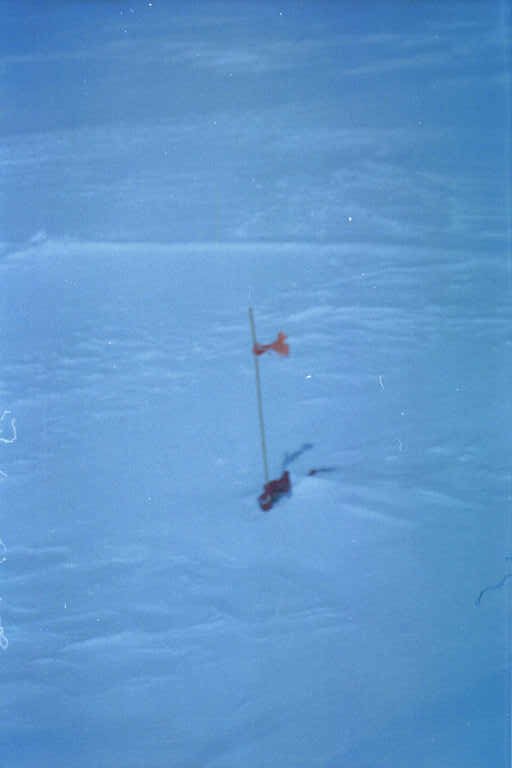
The top of Mustagh Ata was very flat, with no obvious highest point. This marker flag was close to being the highest point.
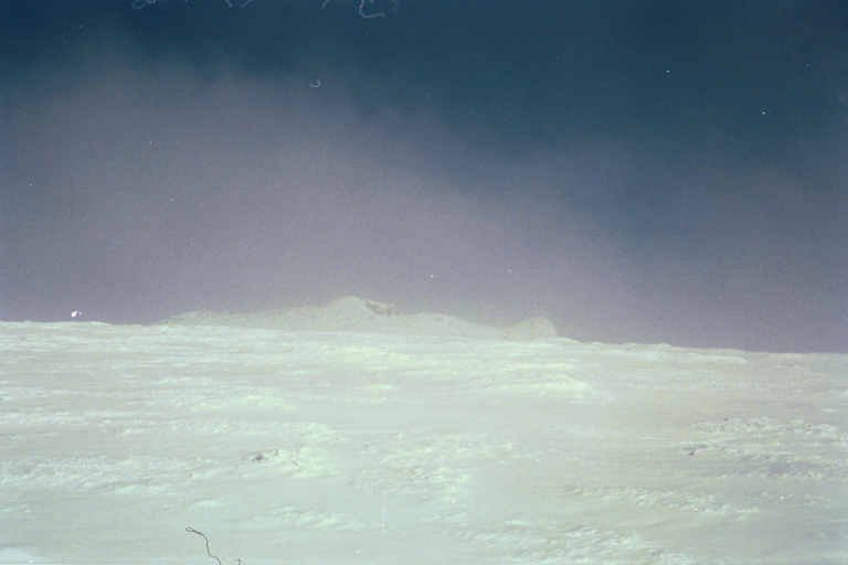
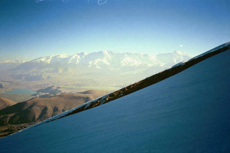
After I had been on top for a while, the clouds cleared a little, and this peak became briefly visible on the other side of a monster gap (presumably it is Mustagh Ata North 7427m on the other side of the Yambulak glacier).
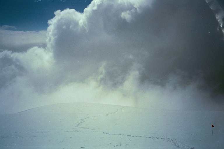
View looking back at my snowshoe tracks. As I started back down, the clouds became very threatening. Fortunately, they dissipated as I descended, and I had good weather all the way back to Camp 2.
The lack of oxygen caused me little difficulty on the descent. As I neared my pack, I met one of the Hungarian climbers. His companion had turned back earlier, and he also quit after continuing only a few more metres. By 7pm I was back at my tent at Camp 2, exhausted from my 13 1/2 hour day, but happy to have soloed Mustagh Ata, alpine style, with only 2 camps above base camp!
Postscript: On my descent I met the 4-man Adventure Consultants group at Camp 3 (6800m). They successfully reached the summit the following day, but no other climbers did so during the during the 7 days I was at Camp 2 even though the weather was mostly good. There was much activity on the mountain below Camp 2, but almost none above. It turns out that quite a few people who reach 7400m don't make it to the summit.